Project Gallery

SNN Sarjapur Road Gallery: Elevation, Lake-Facing Outlook and a 30-Acre Site in Pictures

This SNN Sarjapur Road gallery is written before the renders exist. The project is at pre-launch — a fresh Terms of Reference is under examination, RERA registration is pending, and no official imagery has been issued. What follows is therefore a description rather than a slideshow: the SNN Sarjapur Road elevation as the current drawings define it, the seven-tower massing on a 13.19% footprint, and the southern water frontage that puts this among the few genuinely lake facing apartments Bangalore buyers can consider at this scale. Every dimension below comes from the Revised ToR and the project information sheet. When real photography and renders are released, these are the frames they will fill. SNN Raj Azaleas is useful when buyers are reading images for practical signals: light, approach, amenity scale, landscape maturity, and what still needs official confirmation.

SNN Sarjapur Road Gallery

The aerial frame: seven towers on 13.19% of thirty acres

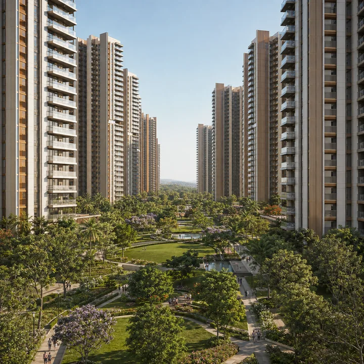
The single most useful image this project can produce is the one taken from directly above. The development area is 1,21,758.77 sq m — 30.09 acres — and the planned ground coverage is 13.19%. Multiply those and the building footprint comes to roughly 16,060 sq m, or just under four acres. That is the number the aerial shot has to communicate: seven towers, lettered A through G and subdivided into fifteen wings, standing on less than a seventh of the land they sit on. Everything else in the frame is landscape, driveway, open space and civic amenity.

Note that the total land area is itself unreconciled between the two source documents — the information sheet records 30.66 acres, the CAF records 11.6321 hectares, or 28.74 acres. Both are disclosed here rather than averaged. The unit count carries the same ambiguity: 2,075-plus in one document, 2,359 in the other, with the current figure marked "Not Available". The aerial view will settle neither, but it will show the proportion, and the proportion is what matters visually.

Land use (Revised ToR)ShareApprox. area
Landscape40.9%49,829.28 sq m (12.31 ac)
Driveway26.9%~32,750 sq m
Ground coverage (buildings)13.19%~16,060 sq m
Park and open space10.00%~12,176 sq m
Civic amenities5.21%~6,344 sq m
Services3.85%~4,688 sq m

Read as a photograph, that table produces a green plate with seven pale forms set into it and a dark band of water along the bottom edge.

The approach along the 30 m road

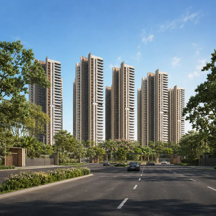
The arrival sequence begins on the 30 m road that serves the site. A wide-format frame taken from the road, looking in, should do two things at once: show the width of the carriageway — a 30 m right of way is generous for this pocket and reads immediately as such against the lane network that feeds much of Kudlu — and show the towers rising behind the entry line rather than crowding it. Because the built footprint is set well back from the boundary, the approach shot has depth: gate, forecourt, planted foreground, then the vertical mass at some distance.

The image should be honest about context. This is not an approach through open country. The corridor either side carries the ordinary texture of South Bengaluru arterial development — compound walls, service establishments, utility runs, construction on adjacent parcels. The transition the photograph has to capture is the one that happens at the threshold, where a 26.9% driveway allocation and a 40.9% landscape allocation take over from the street.

SNN Sarjapur Road elevation: 79.95 metres over a 2B+G+24 massing

The towers are 2B + G + 24 upper floors, rising to 79.95 m. Divide the height by the twenty-five habitable levels and you get roughly 3.2 m floor to floor, which is a standard high-rise section rather than a stretched one — worth saying plainly, because buyers reading "80 metres" sometimes expect double-height drama that the drawings do not promise.

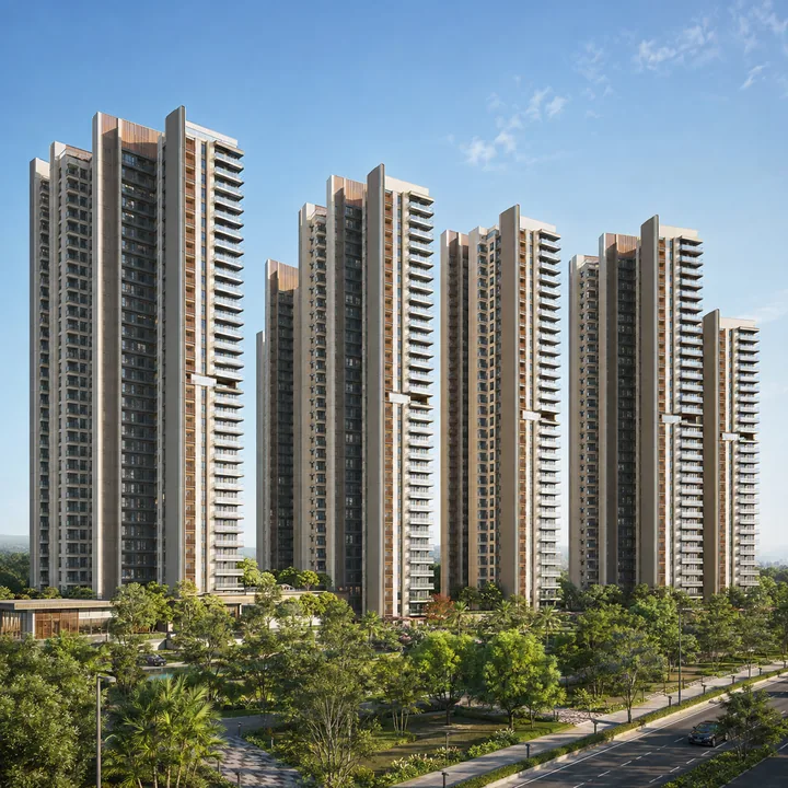
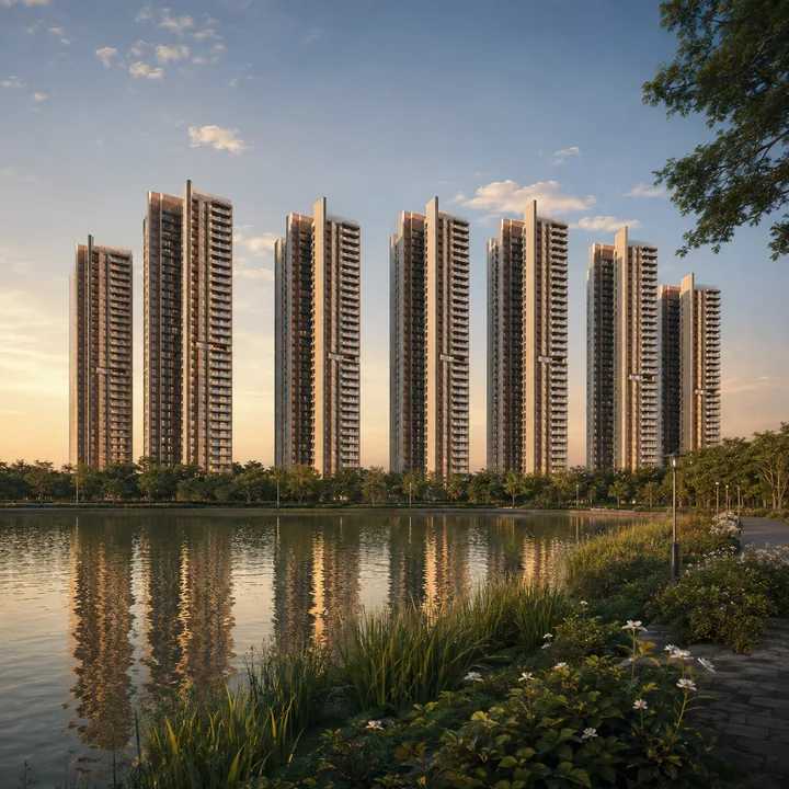
What gives the SNN Sarjapur Road elevation its character is not height alone but the wing structure. Seven towers are subdivided into fifteen wings, so most towers are two- or three-wing assemblies rather than solitary slabs. In elevation that produces stepped, articulated masses with re-entrant corners, service cores expressed between wings, and shadow lines that break up an eighty-metre face. Against the wider Kudlu skyline — which behind the first ring of recent towers is still two- to four-storey fabric — a 79.95 m form is a genuine landmark, visible on the approach from several directions and legible from across the water.

The per-floor arithmetic is worth a frame of its own. Between 2,075 and 2,359 homes spread over fifteen wings and twenty-four upper floors works out to roughly five to seven apartments on a typical wing floor. That is a mid-density lobby cluster, not a corridor of twelve doors, and it is what the elevation's window rhythm should show: repeated bays of five to seven units per wing, stacked twenty-four times.

The arrival court and the tower lobbies

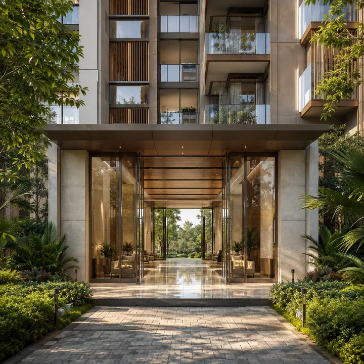
The arrival court is where a 30-acre project either feels like a township or feels like a car park. The frame to capture is the drop-off itself: vehicles turning off the internal driveway into a covered porte-cochère, residents crossing on foot to a lobby entrance, and — critically — no parked cars in shot, because at 4,900 bays across two basements, surface parking should be almost entirely absent. A photograph that shows landscape where a visitor expects asphalt is the single most persuasive image a low-coverage master plan can produce.

Inside, the lobby shots have a specific job in a project of this vintage: to show the transition from a landscaped ground plane straight into a conditioned, finished interior with a clear view back out to green. With fifteen wings, there are fifteen of these entry points, and the gallery should show at least two — one from a lake-facing wing, where the through-view runs from the arrival side to the water side, and one from an internal wing, where the outlook is onto the landscape spine.

The amenity block: B+G+3 at 21 metres

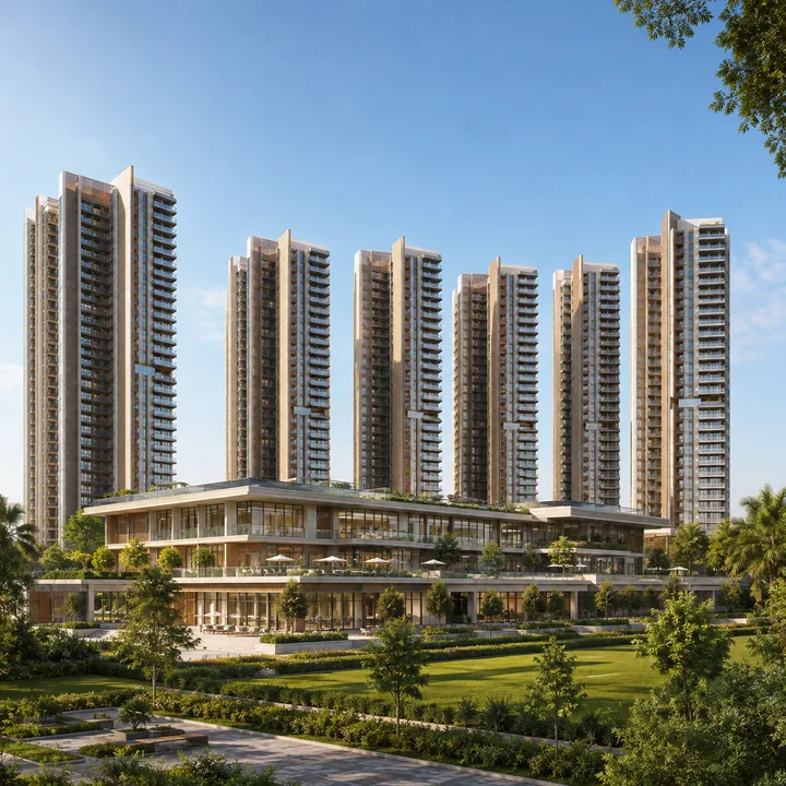
The amenity block is a separate structure, B+G+3, rising to 21 m. Four levels above ground in 21 m means roughly 5.25 m per level — materially more than the 3.2 m in the towers, which tells you the interior volumes are double-height in places: a pool hall, a multipurpose hall, or a full-height atrium. That is a real architectural fact derived from two numbers, and it is what the interior photography should chase. A wide shot from the upper gallery of a double-height volume, looking down and out through glazing to the landscape, is the frame that justifies the block's existence.

Externally, the amenity block at 21 m sits at roughly a quarter of the tower height. Photographed from the landscape side with towers behind it, it reads as a horizontal counterpoint — a long, low, terraced form against seven verticals. That contrast is the master plan's signature composition and should appear in the hero image of any released set.

The landscape spine and the 40.9% green

Landscape is 49,829.28 sq m — 12.31 acres, more than three times the building footprint. A project can hold that number and still spend it badly, so the images that matter are the ones that show it as connected rather than leftover. The gallery should follow a single walk: from the arrival court, through the central spine, past the amenity block, to the southern edge. Shot as a sequence, that walk demonstrates whether the green is one continuous space or a set of disconnected verges.

Ground-level frames should show the shaded walking loop, the pocket seating courts, the event lawn and the transitions between them. Because ground coverage is only 13.19%, the sightlines across this landscape are long — you should be able to stand at one end of the spine and see the amenity block at the other. A telephoto shot compressing that distance, with tower faces on both sides, is how you photograph low density convincingly.

Lake facing apartments Bangalore rarely offers: the southern frontage

Hosa Lake — also called Kudlu Lake locally, and recorded as Hosakere in open mapping — runs along the southern boundary, about 0.15 km from the site pin as the crow flies. Its recorded extent is contested between sources at 32 acres and 45 acres, and the lake buffer is itself unresolved between the ToR narrative (24 m) and the site-plan drawing (30 m). What is not in dispute is the orientation: the water is to the south, and the southern face of the development looks over it.

That produces four distinct photographic conditions across a day, and the gallery should carry all four. Early morning: low eastern light rakes across the water surface, the far bank is in silhouette, and mist sits over the open ground. Mid-morning to afternoon at 13° north: the sun is high and slightly south for much of the year, so the lake-facing balconies get direct light and the water reflects sky rather than sun. Late afternoon: the light turns warm and comes in obliquely from the west along the length of the water, which is the strongest single frame the site can produce. Dusk: the far treeline goes flat, the water holds the last colour, and the tower faces light up from within.

The birdlife belongs in the set too — the lake has a walking track described at around 2 km in route guides, and an open waterbody of this size on the southern edge of a 30-acre site draws waders and roosting birds at both ends of the day. A long-lens frame from the buffer is a more credible image of the amenity than any render.

The commercial point is straightforward. Southern water frontage at this scale does not exist elsewhere in this pincode. The branded comparison in the immediate micro-market is Purva Heritage at Kudlu Gate, a very different proposition at 1.7 acres and roughly 145 units. Lake-facing inventory carries a premium in every Bengaluru corridor where it exists, and buyers should expect the southern-facing stack here to be priced above the internal wings once a price list is issued.

The tree palette, in leaf and in flower

The Revised ToR commits 2,300 trees across twelve species: Kadamba, Neem, Gulmohur, Jacaranda, Champa, Nagalinga Pushpa, Bilvapatre and Bael, Devil's Tree, Asoka, Arjun and Jamun. Against 49,829.28 sq m of landscape that is one tree per roughly 21.7 sq m, or close to one tree per apartment.

This palette is worth photographing twice — once in leaf, once in flower — because four of these species change the entire colour of the site when they bloom. Jacaranda goes lilac across the whole canopy in the pre-monsoon weeks. Gulmohur follows in scarlet through early summer. Champa carries pale, heavily scented flowers over long stretches of the year. Nagalinga Pushpa, the cannonball tree, flowers directly on its trunk in dense pink-and-orange clusters, and a close frame of that trunk is one of the more arresting images a Bengaluru landscape can offer. Kadamba throws round orange-yellow globes with the monsoon; Devil's Tree scents the whole compound for a few weeks in autumn; Arjun holds a pale, smooth bark that photographs well in avenue plantings; Jamun fruits purple in summer. A gallery that shows only green misses most of what 2,300 trees of these species actually do.

Children's play and the sports zones

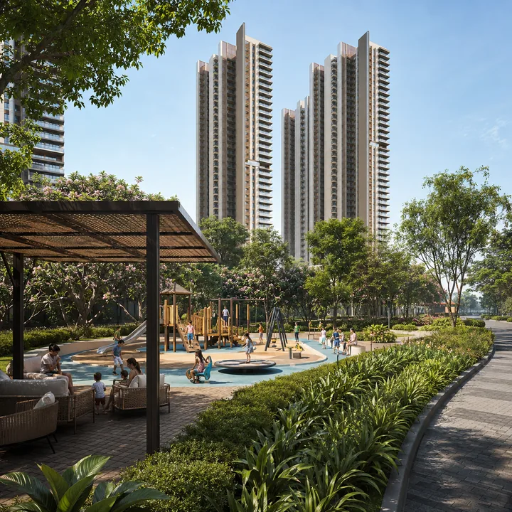
Play and sport should be photographed in use, not empty. In a project of 2,000-plus homes, the children's zones are high-traffic infrastructure, and the frames that carry weight are the ones showing supervision sightlines — play equipment set within view of shaded parent seating, and separated from the driveway network by planting rather than a railing. Because the driveway allocation is 26.9% and all resident parking sits in the basements, the children's zones can be genuinely traffic-free, and the photography should prove it by including the boundary between the two in a single frame.

The sports zones — courts, a jogging loop threading the landscape spine, and the indoor facilities inside the amenity block — photograph best in the hour before dusk, under lights, which is also when they are actually occupied. A night frame of a lit multipurpose court with tower elevations rising behind it does more for a buyer than a daytime shot of empty synthetic surface.

Below grade: the two basements and the services level

Basements rarely appear in a gallery and should here, because the numbers are unusually checkable. Total built-up area is 5,52,042.27 sq m. FAR is 3.26 on a development area of 1,21,758.77 sq m, which accounts for about 3,96,934 sq m. The balance — roughly 1,55,100 sq m — is non-FAR construction, essentially the two basement levels and services. Divide that by the 4,900 planned car parks and you get about 31.7 sq m per bay including aisles and ramps, which is exactly the standard planning allowance. The drawings are internally consistent, and one wide basement photograph with clear ceiling height, marked bays and lit circulation is how you show it.

At 4,900 bays against 2,075 to 2,359 homes, provision runs between roughly 2.1 and 2.4 cars per apartment. The services level carries the rest of the plant: an SBR sewage treatment train of 900 + 700 + 20 KLD against a projected 1,566 KLD of wastewater, a 1,740 KLD BWSSB water demand split 1,156 fresh and 585 flushing, raw-water storage of 975,000 litres plus 100,000 litres overhead, 41 rainwater recharge pits, a 9,170 kW BESCOM connection and ten 500 KVA diesel generators. Those ten sets total 5,000 KVA — around 4,000 kW, or roughly 44% of connected load on backup, which is the sort of detail a plant-room photograph makes concrete.

Night elevation

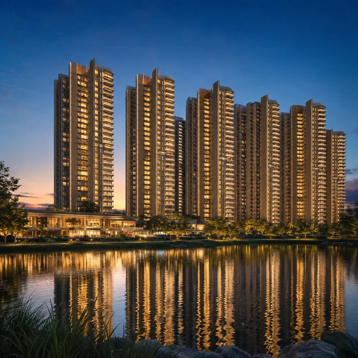
The night frame is the one that will sell the project's scale. Seven towers at 79.95 m, fifteen wings, twenty-five lit levels each, seen across the water from the southern bank with the lake surface carrying the reflection. Shot long-exposure after dusk, when the sky still holds blue rather than going black, the elevation reads as a continuous lit wall broken by the shadow gaps between wings, with the low horizontal band of the amenity block glowing in front of it and the landscape spine picked out in path lighting.

A second night frame should be taken from inside the community looking up — from the landscape spine, with tower faces on both sides and canopy in the foreground. That is the image that shows what living at 13.19% ground coverage feels like after dark: buildings at a distance, planting close, and open sky overhead.

What the site actually looks like today

Photographs of the site dated 15 May 2026 show something quite different from everything described above, and the honest thing to do is publish them alongside the renders when both exist. They show largely open terrain — cleared and part-vegetated ground, scrub and standing trees across the parcel, with construction material stacked in places. There is no structure, no excavation of consequence, and no site office activity of the kind that indicates an imminent start. Around the perimeter, existing high-rise development already stands, so the open ground reads as a gap in an otherwise built-up frame rather than as greenfield land at the city edge.

This is exactly what a pre-launch parcel is supposed to look like. The Terms of Reference is under fresh examination, the approving authority is the BDA, the site falls in the Hi-Tech zone under CDP 2015, and RERA registration has not been granted — so no RERA number exists for this project yet, and no marketing, allotment or booking can lawfully proceed until one is issued. The indicative launch is Q1 2027 with completion targeted at Q1 2032, and both dates are marked tentative in the source documents rather than committed.

A buyer looking at the May 2026 photographs should read them as the baseline against which progress will be measured, not as a disappointment. The gap between open ground and a 79.95 m elevation is five to six years of construction, and anyone underwriting this at pre-launch is underwriting that gap. For a sense of what completed SNN Raj Corp elevations look like photographed rather than described, SNN Electronic City is a useful reference point in the same submarket.

SNN Sarjapur Road residential towers rising 2B+G+24 to 79.95 m above landscaped open space at Kudlu, off Sarjapur Road, Bengaluru

Enquire about SNN Sarjapur Road

Request the brochure, the current cost sheet, floor plates and a site visit for SNN Sarjapur Road.

Enquire Now

SNN Sarjapur Road Gallery - Frequently Asked Questions

Use the enquiry form on this site and specify the configuration band and budget you are working to, and whether you want a weekday or weekend slot. Because the project is pre-launch, a visit today is a site-and-surroundings walkthrough rather than a show-flat tour — expect to see the parcel, the lake edge, the approach road and the surrounding Kudlu Gate stock. That is still worth doing: the approach from Hosur Road through the lane network is the single thing photographs never convey accurately. Ask to see the Etternia handover blocks nearby to judge finish quality on delivered product.

Reported gross yields run 4–6% in Kudlu and 4.5–5.0% in Kudlu Gate, which is at the upper end for Bengaluru. Treat those as indicative: neither figure is derived from paired rent-and-price data on the same units, so the true realised yield on a specific configuration may sit lower. The rental demand driver here is unambiguous — Electronic City, the Outer Ring Road tech belt and now direct Yellow Line access. Home loan rates from around 7.25% as of August 2026 mean a leveraged buyer is not far from carrying cost on rent alone at the lower end of the range.

No road-measured figure for this specific pin is on file, and we will not publish an invented one. The practical answer is that the airport sits at the far northern edge of the metropolitan area and any south-east Bengaluru address is a long cross-city transit, currently by road via the Outer Ring Road and Hebbal. Metro relief is targeted rather than delivered: Blue Line Phase 2A between Central Silk Board and KR Puram is aimed at December 2026, with the airport extension targeted for 2027. Treat all of those as targets, not dates.

No. The relationship is purely locational — this land sits behind Etternia in the same village, and that is the whole of it. Etternia is a completed project with its own K-RERA registration under SNN Properties LLP; this is a separate land parcel that will carry its own approvals, its own environmental clearance and its own future RERA number. Some paperwork circulating on this site labels it as a later phase of the neighbouring project, and that label is factually wrong. Nothing about Etternia's sanction, plan or registration extends to this site.

There is no developer price. The project is unlaunched and unregistered, and the pricing sheet circulating with the source documents is a blank template — it carries plot and villa rows, "unlock offer" in every price cell and a payment ladder running to a 45th-floor slab on a 24-storey tower. What can be stated is market context: in the July–September 2026 quarter Hosa Road averaged ₹12,050/sqft, Kudlu ₹12,000/sqft and Kudlu Gate ₹16,000/sqft, with Haralur Road at ₹15,900/sqft in the preceding quarter. The nearest branded comparisons are small-format and priced accordingly — Purva Heritage , a 1.7-acre single-tower pre-launch of around 145 units roughly 110 m (straight-line) from Kudlu Gate metro, is quoting near ₹16,000/sqft at EOI stage, while Mahindra Zen at Singasandra sells 3 BHK at ₹1.99 crore for 1,827 sqft, about ₹10,890/sqft. Scale usually prices below boutique, which is the pocket this project would occupy. A large-format launch here would reasonably sit in the ₹11,500–13,500/sqft band with a working core of ₹12,000–13,000, set against Prestige Southern Star's ₹12,000–14,000/sqft at launch — but that is a market-derived expectation, not a quoted rate.

Kudlu Gate is the station you will actually use — about 3.1 km by road, the shortest drive of the three. The straight-line ranking is misleading here and worth understanding: as the crow flies Singasandra is closest at 2.32 km, then Hosa Road at 2.35 km, then Kudlu Gate at 2.79 km, but the Hosur Road elevated-expressway and its service-road median force a long detour, so by road that order reverses and Singasandra becomes the farthest at roughly 4.3 to 6.4 km. Straight-line distance is not road distance — the site sits behind Etternia on a lane network, so actual driving distance is materially longer. All three are on the Namma Metro Yellow Line, the 19.15 km RV Road to Bommasandra corridor inaugurated on 10 August 2025 with 16 fully elevated stations, and all three share the project's own 560068 pincode, which is a checkable proximity proof. The site is not walkable to any of them at roughly 40 minutes on foot, but BMTC introduced eight Yellow Line feeder routes in March 2026, two of which stop at Haralur and Haralur Cross on the project's own road. One caveat before buying on the metro story: RV Road (Green Line) is the only live interchange today — Jayadeva Hospital for the Pink Line and Central Silk Board for the Blue Line are still under construction and should not be treated as usable.